Locals raise concerns about slow drainage of flood waters coupled with backflow in Seraulim and Mungul

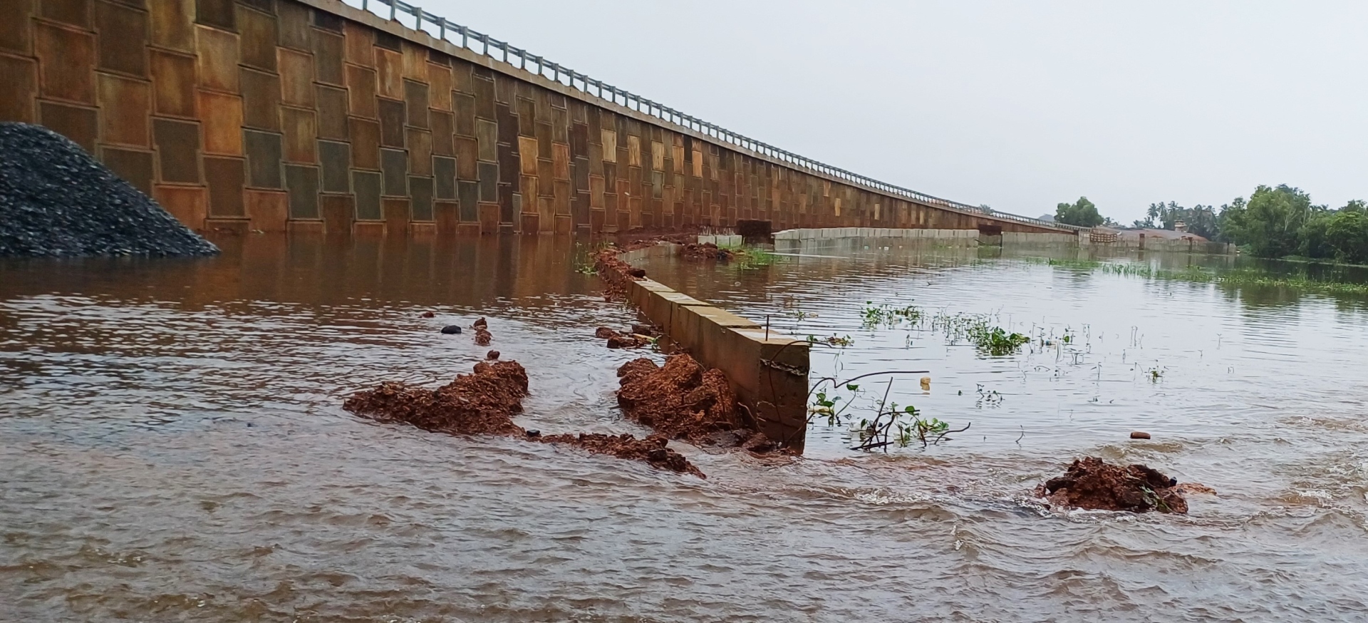
The construction of an earth dam by Tolleaband is responsible for the flooding of a road near the bypass
The huge earthen dam that runs across the Tolleband waterbody and makes way for the Western Bypass.
Photo credit: Santosh Mirajkar
MARGAO
What could be the possible reasons for the inundation of large parts of the Sal River flood plains and the slow drainage of flood waters in Benaulim, Mungul, Seraulim and Nuvem along the Western Bypass – is it the huge earthen embankment constructed by the Road Department right through the flood plains to make way for the bypass or is it simply the silted Sal River obstructing the rapid drainage of flood waters?
Apart from the revenue officials, have representatives of the PWD, the Road and Water Resources Department, the Ministry of Agriculture and Biodiversity also visited these villages to examine the floods, take stock of the actual situation and suggest measures for the speedy drainage of the flood waters?
These and other questions are troubling villagers and farmers for a simple reason: although the rains have eased somewhat over the weekend, the water catchment areas and flood plains of these villages are still under water.
Locals in the know say it is not uncommon for the Sal River’s watersheds and wetlands to be flooded during the monsoon. But what is worrying farmers and villagers is the slow drainage of the floodwaters coupled with the backflow of water in Seraulim and Mungul villages.
Villagers and farmers had been waging a sustained struggle for the construction of the Western Bypass on stilts along the 2.5 km stretch of the bypass through Seraulim, Mungul and Benaulim. While the government later agreed to construct the bypass on stilts along the 900 m stretch from Seraulim to Mungul, the remaining stretch through Benaulim will be constructed by creating an earthen embankment.
During a visit to Tolleaband-Benaulim early last week, when the roads were under water, it was clear that the huge earthen dam had divided the water body into two halves, with the service road on the western side submerged.
Locals suspect that the construction of the huge earthen dam by the Tolleaband body is the main cause of the two-day flooding of the road near the bypass. Villager Rudolf Barretto says that this is precisely why villagers and farmers demanded the bypass be built on stilts. “It is well known that when you build something in a body of water, especially in a watershed, the water gets displaced and overflows. We saw this in the last week when the water did not drain quickly,” he said.
Rudolf recalled that the Water Resources Ministry had warned the government in its reports against building the bypass on stilts, but in vain. “If you look at the reports of the Water Resources Ministry, it is clear that the officials had foreseen this situation and therefore advocated the bypass on stilts,” he said.
Goa Forward Chief Vijai Sardesai drew the attention of the House to the problem of flooding in the low-lying areas of Benaulim, Mungul, Seraulim and Davondem and appealed to the government to at least implement the recommendations of central expert RK Pandey. “Since the government has cleared its path by constructing the Western Bypass without stilts, at least Pandey’s recommendations should be implemented to mitigate the impact of flooding in the low-lying areas along the Bypass,” Sardesai said.


