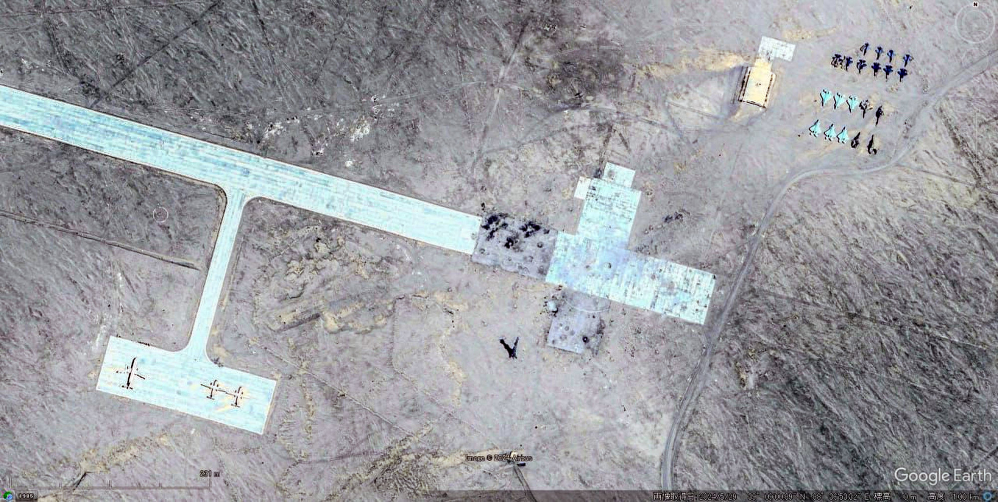
Do these satellite images provide clues to China’s war strategy against the USA?

The military blogging account identified the location as Qakilik in the Taklamakan Desert. The Post could not verify the images and there was no official confirmation from China.
Some of these replicas appeared to be badly damaged.
The exercises reflect the People’s Liberation Army’s efforts to expand its long-range ballistic missile and cruise missile systems to neutralize the threat posed by U.S. naval forces, says Collin Koh, a research fellow at the S. Rajaratnam School of International Studies in Singapore.
“The naval forces of the United States and its allies would generally be a natural target because of their power projection capabilities, which are perceived as a threat by Beijing,” he said.
If the exercise also involved the use of PLA intercontinental weapons systems, it could have rehearsed attacks on targets such as Guam, Alaska and Hawaii, he added.
The PLA has long maintained that its exercises do not target any particular party, but decoy targets can sometimes give away its intentions – whether accidentally or intentionally.
Malcolm Davis, a senior analyst at the Australian Strategic Policy Institute, said the exercise appeared to fit into the PLA’s counter-intervention strategy, which aims to deny U.S. and allied naval forces in the Western Pacific access to potential war zones further east.
“This means that the PLA’s strike capabilities will likely have an electro-optical or synthetic aperture radar guidance system to image the target and guide the warhead before it precisely hits a specific location on a military base,” he said.
The exercise would enable the PLA to improve its precision in scenarios such as launching a ballistic missile “attempting to hit a moving target at sea, such as an aircraft carrier.”
He also said the desert exercises would help the PLA improve its ability to launch long-range conventional precision strikes on land targets such as airfields.

Hong Kong-based military commentator Leung Kwok-leung said the satellite images suggested a simulated attack on Alaska, where most of the F-22 bombers were based.
“Alaska is also the base of the US’s main national missile defense system. Last year, an F-22 was used to shoot down China’s so-called spy balloon, which shows that the F-22 also takes on the role of missile defense system,” Leung said.
Timothy Heath, a leading international defense researcher at the Rand Corporation think tank, also said: “The Chinese are not hiding the dummies, so maybe they don’t care if they are seen in the West.”
“It may also be that the Chinese want the U.S. military to see this as a reminder that China is serious about military training and preparation, and as a warning to the United States,” Heath said.

.jpg?itok=HN_FTHj9)


