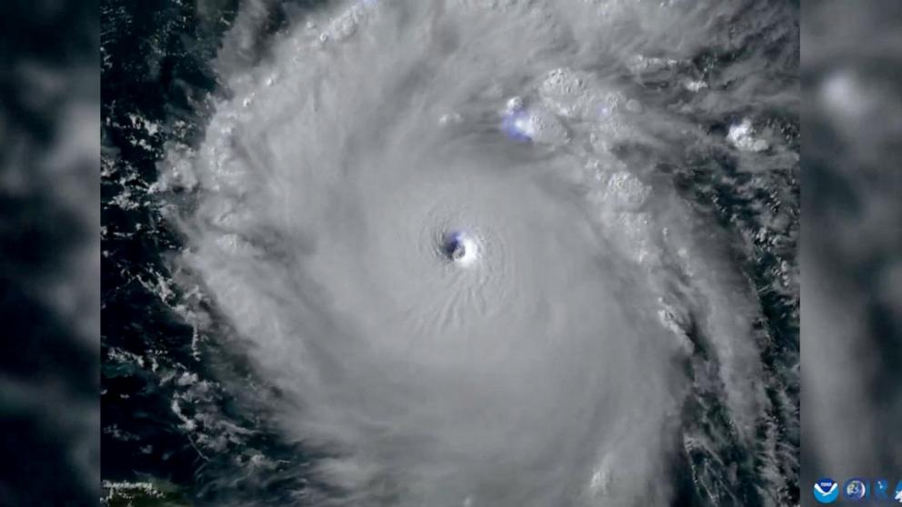
Hurricane Beryl: Forecast and course: Jamaica’s Prime Minister declares island a “disaster area” ahead of storm

As Hurricane Beryl heads toward Jamaica, the country’s Prime Minister, Andrew Holness, declared the entire island a disaster area as a precautionary measure in a speech to the public on Tuesday evening.
Holmes also said an island-wide curfew will be in effect from 6 a.m. to 6 p.m. local time on Wednesday.
Although the cyclone lost some of its strength on its way to Jamaica, it has already claimed six lives in the Caribbean.
According to the National Hurricane Center, Beryl’s rating was downgraded from Category 5 to Category 4, but maximum sustained wind speeds remained dangerous at 250 km/h.
Beryl is expected to continue to weaken as it moves through the Caribbean Sea, but will still become a major hurricane when it reaches Jamaica on Wednesday.
In anticipation of the storm, Jamaican authorities plan to close three airports on Tuesday. They will remain closed until Wednesday, and reopening will be announced after the post-storm situation is assessed.
According to the Jamaica Tourist Board, Sangster International Airport (Montego Bay) will close at 11:59 p.m. on Tuesday evening, Norman Manley International Airport (Kingston) at 10:00 p.m. and Ian Fleming International Airport (Ocho Rios) at 7:00 p.m.
The hurricane killed three people in Cariacou, Grenada, where it made landfall on Monday, authorities said. One other death from the storm was reported in St. Vincent and the Grenadines, and two people were killed in northern Venezuela, authorities in those countries said.
Overnight, Hurricane Beryl strengthened into a Category 5 hurricane as it made its way through the warm waters of the Caribbean Sea, making it the strongest July Atlantic hurricane ever recorded.
Earlier Tuesday, Beryl reached top winds of 165 mph (265 kph), surpassing Hurricane Emily’s July record of 160 mph (260 kph) set in 2005, the National Hurricane Center said.
Hurricane Beryl is expected to reach Jamaica and bring rainfall of 10 to 20 centimeters to the mountainous island state, with up to 30 centimeters possible in isolated cases. This could lead to flash floods in vulnerable areas.
The storm moved slightly northward, taking a trajectory that would potentially bring it dangerously close to the coast of Jamaica Wednesday afternoon or evening with maximum sustained winds of 130 mph (210 km/h). A storm surge of up to 8 feet (2.4 meters) is expected, and the hurricane is expected to dump up to 12 inches (30 centimeters) of rain.
Beryl’s outer bands could also hit southern parts of the Dominican Republic and Haiti late Tuesday and Wednesday, possibly bringing rainfall of between 5 and 15 centimeters.
Residents of St. Vincent and the Grenadines were busy cleaning up and assessing the damage on Tuesday. Schools, homes, buildings and farmland were badly damaged by the hurricane, authorities said. On Union Island, which is part of St. Vincent and the Grenadines, 90% of homes were either destroyed or badly damaged, and the roof of Union Island’s airport was ripped off by the hurricane’s buzzsaw-like winds. Severe damage was also reported at Argyle International Airport on St. Vincent.
The only death reported in the Grenadines occurred on the island of Bequia, according to official figures.
After touring the devastated areas on Tuesday, Prime Minister Ralph Gonsalves told reporters that Beryl had “left a trail of immense destruction.”
Sea surface temperatures in the eastern Caribbean Sea, where Beryl is currently located, are warmer than average for this time of year and are more consistent with levels at the peak of the Atlantic hurricane season than in early July, providing ample fuel for Beryl’s extreme intensification.
The latest forecast calls for little change in strength overnight, with the storm gradually weakening starting Tuesday as it moves west-northwest over the Caribbean Sea.
Beryl will continue to move across the Caribbean throughout the week and will approach Jamaica on Wednesday. By then, it will likely weaken to a Category 2 storm. The center and worst impacts will likely be south of the island. However, the latest forecast calls for the storm’s center to pass a little closer to Jamaica, so heavier rain, winds and storm surge are possible along its current track.
A weakening trend will continue for the rest of the week as Beryl moves over the Caribbean Sea and encounters less favorable atmospheric conditions.
Beryl will then move toward Mexico’s Yucatan Peninsula by the end of the week. The current forecast calls for the system to make a second landfall on the east coast of the Yucatan Peninsula sometime on Friday. After that, the system will likely move into the southwestern Gulf of Mexico/Bay of Campeche, continue to weaken, and move toward parts of eastern Mexico as a tropical storm next weekend.
Unfortunately, the same area of eastern Mexico will now likely be affected by all three of the first three storms of the 2024 Atlantic hurricane season. Having already been hit by Alberto and Tropical Storm Chris, Beryl will likely have at least some impact on the same region over the course of the coming weekend.


